 |
| Figure 1 |
 |
| Figure 2 |
Introduction
This final exercise involved working with navigation and took place out at the Eau Claire Priory which is about 4 miles south of the University. Earlier in the semester, each students made a navigation map of this area. The best map was selected from each group and used with a compass and a back up GPS to mark 5 of the points on the navigation course on the property. Figure 1 to the left displays the locations that were assigned to group 2 by professor Joseph Hupy. Figure 2 to the right shows the device that was used in connection with the bad elf app that was downloaded prior to class. This device was used to track the students as they went throughout the lab and it showed a detail track log. The first step after receiving the navigation maps from earlier was to manually plot out the points on the map and to label them, in order to get the bearings of where to start and finish the exercise.
 |
| Figure 3 |
 |
| Figure 5 |
 |
| Figure 4 |
Figure 3 to the upper left shows the GPS that was used to navigate the priory. This proposed somewhat of a problem due to the steep terrain of the Priory property, as the hills caused a few loses in satellites. Figure 4 is the location marking tape that was used and figure 5 shows the location marking spray paint that was used to mark a band around the tree at tree height to assist groups that will be completing the navigation course at other times.
 |
| Figure 6 |
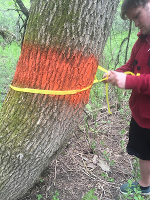
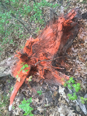
Figures 6-9 show the process of marking the navigation locations, which are trees. The spray paint was put about 10 inches thick around chest height for easy visibility. The navigation to the trees was done using Google Maps, the compasses on the students phones, the Bad Elf GPS and the Garmin GPS.
 |
| Figure 7 |
 |
| Figure 8 |
 |
| Figure 9 |


No comments:
Post a Comment